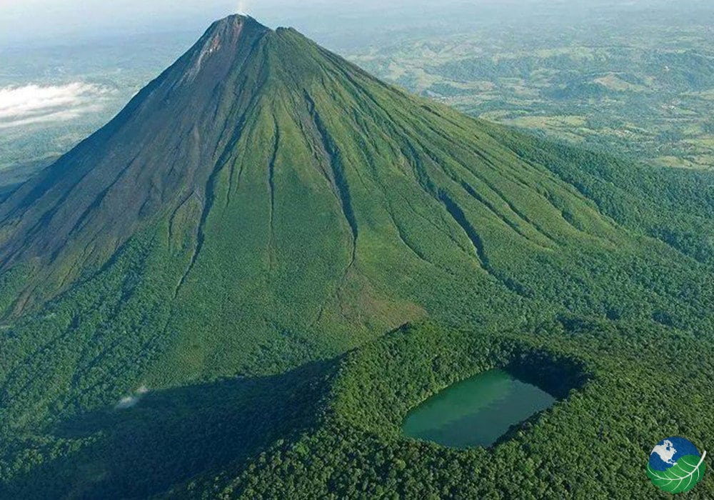
Best Viewpoints of Arenal Volcano
Arenal Volcano rises above the rainforest near La Fortuna, creating one of Costa Rica's most recognizable landscapes. Its steep volcanic cone can be seen from national park trails, lakeside roads, nature reserves, and selected hotels. However, finding the best viewpoints of Arenal Volcano involves more than choosing a location. Clouds frequently gather around the summit, sometimes hiding the entire cone while nearby areas remain sunny. Some viewpoints offer wide landscapes with Lake Arenal in the foreground. Others provide closer perspectives framed by forest, volcanic rock, or open countryside. Access also varies. Certain viewpoints are inside national parks or private attractions, while others are available only to hotel guests. This guide compares six viewing areas, explains what makes each one different, and offers practical photography advice. It also covers weather, timing, and how to plan a visit without relying on guaranteed clear skies. Understanding Arenal Volcano and Its Surrounding Landscape Arenal Volcano stands near La Fortuna in northern Costa Rica. It reaches approximately 1,670 meters (5,479 feet) above sea level. The volcano is a stratovolcano formed through repeated eruptions of lava and other volcanic material. Arenal began a prolonged eruptive period in July 1968. Activity continued for decades before declining in 2010. Today, the volcano remains geologically active but is not producing the frequent visible lava flows associated with its earlier eruptive period. Visitors observe Arenal from surrounding trails, roads, hotels, and designated viewing areas. Climbing the active volcanic cone is prohibited. The surrounding landscape includes Arenal Volcano National Park, Lake Arenal, rainforest reserves, farmland, and thermal resorts. These different environments create varied photography opportunities. For example, national park trails provide volcanic rock and forest foregrounds. Meanwhile, lakeside viewpoints offer broader compositions with water and hills. Why Is Arenal Volcano Sometimes Hidden by Clouds? Arenal's location and surrounding climate strongly influence visibility. Warm, moist air moves through the region and interacts with the volcano's slopes. As air rises and cools, clouds can develop around the mountain. Consequently, the summit may disappear even when the surrounding countryside looks relatively clear. Rainfall also occurs throughout the year. Arenal does not follow the same pronounced dry-season pattern as Costa Rica's northwestern Pacific coast. This means that December through April does not guarantee clear skies. Likewise, the wetter months can still produce periods of good visibility. Early mornings sometimes offer favorable conditions. However, there is no reliable daily window when the summit is guaranteed to appear. For photographers, flexibility is more useful than following a fixed schedule. Spending several days in the region may provide more opportunities to photograph the volcano under changing conditions. Best Viewpoints of Arenal Volcano The following locations offer different perspectives of Arenal. Some require paid admission, while others involve private accommodation or roadside access. 1. Arenal Volcano National Park — Best for Volcanic Landscapes Arenal Volcano National Park is one of the most established places to observe the volcano. The park protects forest and volcanic terrain affected by earlier eruptions. Trails in the main visitor sector include Las Coladas and El Ceibo. The Peninsula sector provides another area to explore when officially accessible. Las Coladas is particularly interesting for visitors who want to photograph volcanic terrain. Older lava deposits, rocky ground, and regenerating vegetation create a distinctive foreground. However, open views are not available along every section of the trail. Trees, terrain, and clouds can interrupt sightlines. Visitors should also expect uneven surfaces and changing trail conditions. The park does not permit climbing the active cone. Therefore, photographs must be taken from authorized trails and observation areas.…