Tenorio Volcano National Park is best known for the turquoise waters of Río Celeste, but the waterfall is only one part of its importance. This protected landscape in northern Costa Rica contains volcanic formations, exceptionally wet forests, diverse wildlife habitats, and waterways that support the surrounding region.
For visitors, the main experience is a rainforest hike through a small, designated section of the park. Along the way, the trail reveals a waterfall, a blue lagoon, volcanic gas emissions, and the unusual point where Río Celeste develops its color.
However, the national park extends far beyond the public trail. Much of its value lies in forests and volcanic terrain that ordinary tourists cannot explore.
Understanding that distinction makes a visit more meaningful. Tenorio is not simply a place to photograph a blue river. It is an important protected area within Costa Rica’s volcanic mountain landscape.
Tenorio Volcano National Park at a Glance
| Feature | Details |
|---|---|
| Official name | Parque Nacional Volcán Tenorio |
| Location | Northern Costa Rica, Guanacaste Volcanic Range |
| Provinces | Alajuela and Guanacaste |
| Conservation area | Arenal-Tempisque Conservation Area |
| Established | June 8, 1995 |
| National park area | Approximately 12,872 hectares |
| Park and adjoining Tenorio Protected Zone | Approximately 18,402 hectares combined |
| Main gateway | Bijagua |
| Visitor entrance | El Pilón sector, approximately 9 km from Bijagua |
| Main trail | Misterios del Tenorio |
| Full trail distance | Approximately 6 km round trip |
| Typical hiking time | Around 3 hours |
| Admission hours | 8:00 a.m.–2:00 p.m. |
| Visitor departure deadline | 4:00 p.m. |
| Tickets | Advance purchase through SINAC |
| Swimming | Prohibited inside the national park |
The figures above follow the official information published by Costa Rica’s National System of Conservation Areas, known as SINAC.
Where Is Tenorio Volcano National Park?
Tenorio Volcano National Park lies along the southeastern portion of the Guanacaste Volcanic Range.
Its protected territory extends across parts of Alajuela and Guanacaste provinces, although many visitors approach it through Bijagua, a small community in the Upala area.
Bijagua is approximately 9 kilometers from the park’s main visitor entrance. However, the town itself is not inside the national park.
Travelers commonly reach the area from La Fortuna, Liberia, or Guanacaste’s northern beaches.
La Fortuna is a convenient starting point for a day trip, but Tenorio is a separate destination from Arenal Volcano National Park.
The distinction matters when planning transportation. Searching for the volcano’s summit instead of the official Río Celeste entrance can lead to an unsuitable route.
For most visitors, the correct destination is the authorized park entrance near Bijagua.
Why Was Tenorio Volcano National Park Created?
The park was established on June 8, 1995, under Executive Decree No. 24290-MIRENEM.
However, protection of the Tenorio area began decades earlier. In 1955, Costa Rica established legal protection around the volcano’s crater. Additional forest and protected-area designations followed.
Today, the national park works alongside the adjoining Tenorio Protected Zone to conserve a larger landscape.
The distinction also explains why different publications report different area figures. SINAC identifies approximately 12,872 hectares for the national park itself and approximately 18,402 hectares for the park and protected zone combined.
The area’s conservation value extends beyond scenic attractions. Its forests protect wildlife habitat, maintain vegetation across different elevations, and help safeguard important water resources.
The landscape also forms part of the Agua y Paz Biosphere Reserve, recognized by UNESCO in 2007.
Consequently, protecting Tenorio contributes to conservation efforts across a broader region of northern Costa Rica.
Tenorio Volcano: Geology and Volcanic Landscape
Is Tenorio an Active Volcano?
Tenorio is a volcanic complex with evidence of past volcanic activity and present-day geothermal features.
However, it is not a volcano known for ongoing eruptions.
The Smithsonian Institution’s Global Volcanism Program reports no confirmed historical eruptions at Tenorio. Costa Rica’s National Seismological Network also describes it as a dormant volcano without recorded historical eruptive activity.
This does not mean the volcanic landscape has become geologically irrelevant.
Hot springs, gas emissions, and mineral-rich waters demonstrate that geothermal processes remain important in the area.
The Tenorio Volcanic Complex
Tenorio is not a single, isolated cone.
The volcanic massif includes several cones, craters, and overlapping lava formations. Its main summit reaches approximately 1,916 meters above sea level.
Cerro Montezuma is another recognizable feature of the complex.
From the authorized visitor trail, a viewpoint may provide views toward several volcanic cones when clouds permit.
However, the standard national park hike does not lead to the summit or crater.
Geothermal Features
Volcanic gases and naturally heated waters occur in parts of the Tenorio landscape.
One of the most accessible examples is Borbollones, along the Misterios del Tenorio trail.
Here, gases escape through the water, producing visible bubbling.
Visitors should observe this feature only from authorized areas. It is not a bathing location, and geothermal water should not be treated as safe to touch.
How Geology Influences Río Celeste
The park’s geology also contributes to the conditions that produce Río Celeste’s unusual appearance.
At Los Teñideros, Río Buenavista meets Quebrada Agria. The interaction of their waters promotes the formation and suspension of particles that scatter sunlight.
This creates the river’s distinctive blue-green appearance.
The color is not caused simply by sulfur, nor is the water artificially dyed.
The Rainforest Ecosystems of Tenorio Volcano National Park
Tenorio protects several forest environments influenced by rainfall and elevation.
According to SINAC, the area includes tropical very humid forest, premontane rainforest, lower montane rainforest, and transitional forest zones.
These classifications describe ecological conditions rather than separate tourist attractions.
Why the Forest Is So Green
Much of the protected area receives substantial rainfall throughout the year.
SINAC reports an annual average of approximately 3,500 millimeters for the wider park and protected-zone landscape.
This moisture supports dense vegetation, including ferns, palms, heliconias, bromeliads, and orchids.
Large trees create a layered forest structure, while smaller plants occupy the understory and forest floor.
As a result, even visitors focused on the waterfall encounter a much wider range of plant life along the trail.
Forests at Different Elevations
Environmental conditions change as elevation increases.
Higher areas experience different temperatures, moisture patterns, and vegetation communities from lower forest sections.
These variations support ecological diversity across the volcanic massif.
However, the public visitor trail provides only a limited view of this larger system. Travelers should not expect to experience every forest type during a single hike.
Wildlife in Tenorio Volcano National Park
The national park protects habitat for a wide variety of animals.
However, wildlife recorded within the protected landscape is not necessarily easy to see along the tourist trail.
Mammals
SINAC identifies species including Baird’s tapir, white-faced capuchin monkeys, pumas, ocelots, margays, agoutis, and pacas.
These animals occupy different habitats and have different activity patterns.
Large mammals and wild cats are especially difficult to observe during an ordinary daytime visit.
Therefore, the presence of a species in the park should never be interpreted as a promise of a sighting.
Birds
Tenorio’s forests support a diverse bird community.
SINAC documents species such as the bare-necked umbrellabird, sunbittern, and crested guan.
Birdwatchers may enjoy listening for calls and observing activity around the forest edges.
However, dense vegetation, rainfall, and limited visibility can make identification challenging.
A guide with local bird knowledge may improve the experience, although sightings remain unpredictable.
Reptiles, Amphibians, and Smaller Wildlife
The park also supports snakes and other forest animals.
SINAC identifies several snake groups, including venomous species. Visitors should watch where they step and avoid touching unfamiliar wildlife.
Frogs, insects, and other small organisms contribute to the forest’s ecological processes.
Even when larger animals remain hidden, observing smaller wildlife can provide insight into the surrounding ecosystem.
Responsible Wildlife Observation
Remain on marked trails, keep a respectful distance, and avoid feeding animals.
Never move wildlife for photographs or attempt to attract animals with food.
Quiet observation is usually more appropriate than pursuing a particular sighting.
Tenorio Volcano National Park Hiking Trails
Misterios del Tenorio Trail
The main authorized visitor route is Misterios del Tenorio.
SINAC describes it as a linear natural trail extending approximately 3 kilometers in one direction, or 6 kilometers round trip.
The standard visit takes around three hours, although rain, photography, and walking pace can increase the duration.
The route connects the park’s principal visitor attractions.
| Attraction | What visitors can observe |
|---|---|
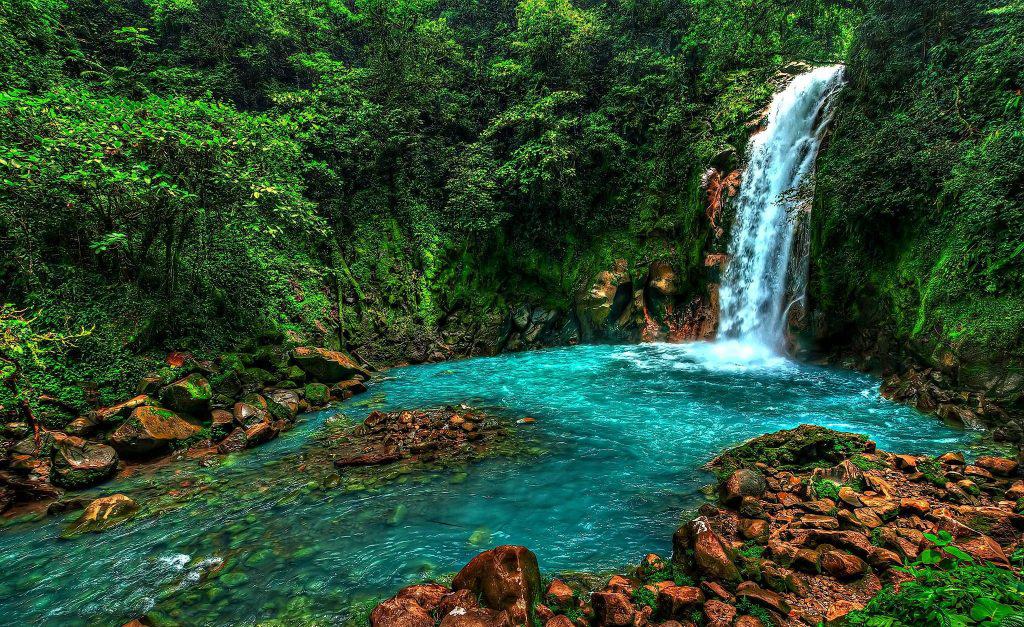
| Río Celeste Waterfall | A waterfall and turquoise pool from a viewpoint |
| Volcano viewpoint | Parts of the Tenorio volcanic massif when visible |
| Laguna Azul | An intensely colored natural pool |
| Borbollones | Volcanic gas emissions through water |
| Los Teñideros | The confluence associated with the river’s color change |
The waterfall requires descending a steep staircase and climbing back up.
Elsewhere, the trail includes roots, slopes, uneven ground, and muddy sections.
Can You Hike to the Summit of Tenorio Volcano?
The standard visitor route does not provide access to the summit.
Travelers should not assume that an unofficial route or privately advertised excursion authorizes entry into restricted national park areas.
Before considering any alternative hike, verify its location, legal access, and authorization with the relevant land manager or SINAC.
Are There Other Public Trails?
SINAC’s standard visitor information centers on Misterios del Tenorio.
The existence of forest paths, research routes, or tracks elsewhere in the protected area does not make them public hiking trails.
For ordinary visitors, the authorized route should be the basis of the itinerary.
Río Celeste: The Park’s Best-Known Attraction
Río Celeste is the feature that brings many travelers to Tenorio.
The waterfall offers a view of blue-green water surrounded by forest. Meanwhile, Laguna Azul provides another example of the river’s unusual appearance.
At Borbollones, visitors can observe evidence of geothermal activity.
Finally, Los Teñideros provides a direct connection between the landscape’s chemistry and its distinctive visual character.
However, the river does not always appear intensely blue.
Heavy rainfall can introduce additional sediment and reduce water clarity.
Beyond Río Celeste: Why the Wider Park Matters
The public trail reveals only a small portion of Tenorio’s protected landscape.
Beyond the viewpoints, the park conserves extensive forest, volcanic terrain, and wildlife habitats.
Its elevation changes create different environmental conditions, while its waterways connect the volcanic highlands with surrounding areas.
The park also protects species that most tourists will never encounter.
This is an important distinction. The ecological value of a national park cannot be measured solely by the attractions open to visitors.
Some areas remain inaccessible precisely because conservation requires limiting human activity.
Tenorio’s role within the Agua y Paz Biosphere Reserve further places it within a larger regional conservation landscape.
For visitors, appreciating these connections adds depth to the experience without requiring access to restricted areas.
Conservation and Responsible Tourism
Protected forests provide habitat, maintain vegetation cover, and help protect water resources.
At Tenorio, these functions are particularly important because the landscape receives substantial rainfall and contains sensitive volcanic and river environments.
Tourism creates opportunities for environmental education, but it also requires careful management.
SINAC publishes limits on visitor numbers and restricts access to designated routes.
Visitors can help by remaining on trails, respecting barriers, and leaving natural features undisturbed.
Swimming and entering the river are prohibited inside the national park.
The park also prohibits pets, drones, single-use plastics, alcohol, and smoking.
Following these rules helps reduce unnecessary pressure on the protected environment.
Can You Swim Inside Tenorio Volcano National Park?
No. SINAC prohibits entering the river within the national park.
This applies to Río Celeste Waterfall, Laguna Azul, and the protected water features along the visitor route.
The geothermal areas also present hazards that visitors should not approach.
Swimming opportunities advertised outside the national park operate under separate access rules.
However, a location being outside the park does not automatically make its water safe.
How Difficult Is Visiting Tenorio Volcano National Park?
The full trail requires moderate physical effort.
Although the distance is manageable for many active travelers, the terrain can be uneven and slippery.
The waterfall staircase adds another challenge.
Beginners who are comfortable walking several kilometers may enjoy the route. However, visitors with balance, knee, or mobility concerns should assess conditions carefully.
Families with active children may also enjoy the hike, particularly when they allow extra time.
The main natural trail should not be considered wheelchair-accessible or suitable for ordinary strollers without specific confirmation from the park.
Tenorio Volcano National Park Entrance Fees and Tickets
SINAC publishes the following admission rates, including tax.
| Visitor category | Published admission |
|---|---|
| Nonresident adult | US$13.56 |
| Nonresident child | US$5.65 |
| Costa Rican or resident adult | ₡904 |
| Costa Rican or resident child | ₡565 |
| Children under 2 | Free |
| Eligible Costa Rican or resident older adults | Free |
Tickets are purchased through the official SINAC online reservation system.
Confirm the applicable child category and any required registration for visitors with free admission.
Visitors should also carry appropriate identification for their ticket category.
Private parking near the entrance is charged separately. The official park page does not establish a universal parking fee.
Because prices and procedures may change, check the reservation platform before traveling.
Tenorio Volcano National Park Opening Hours
SINAC lists the park as open daily.
Visitors may enter between 8:00 a.m. and 2:00 p.m. Everyone must leave by 4:00 p.m.
Arriving early provides more time to complete the hike without rushing.
However, morning arrival does not guarantee dry weather or clear blue water.
Check current park notices before departure, especially after severe rainfall.
Best Time to Visit Tenorio Volcano National Park
Tenorio receives rainfall during much of the year, partly because of Caribbean weather influences.
Consequently, visitors should prepare for wet conditions even during periods that are relatively dry elsewhere in Costa Rica.
Rain supports the forest’s vegetation, but it can also make the trail muddy.
Heavy rainfall may increase sediment in Río Celeste, temporarily changing its appearance.
There is no month that guarantees ideal river color.
For most travelers, choosing a day with suitable local conditions and allowing enough hiking time is more useful than relying on a seasonal promise.
How to Get to Tenorio Volcano National Park
Bijagua is the main gateway to the visitor entrance.
Travelers can reach the area by rental car, organized tour, or private transportation.
From La Fortuna or Liberia, driving commonly takes approximately 1.5–2 hours, depending on the route and conditions.
Papagayo Peninsula, Playa Hermosa, and Playas del Coco generally involve longer journeys.
Tamarindo and Playa Flamingo can require substantially more driving time.
Public transportation to Bijagua may be possible, but reaching the park entrance can require an additional taxi or transfer.
Do not rely on unverified bus schedules when planning a timed admission.
Where to Stay Near Tenorio Volcano National Park
Bijagua is a practical base for travelers who want to visit the park without a long morning drive.
Staying nearby can also make it easier to explore the surrounding rural landscape at a slower pace.
La Fortuna is better suited to travelers planning several activities around Arenal Volcano.
Meanwhile, Guanacaste’s coastal destinations work well for visitors whose main priorities are beaches and resorts.
An overnight stay near Bijagua may be worthwhile when combining destinations or traveling with children.
What to Bring
Choose footwear with good traction, especially during wet weather.
Bring a lightweight rain jacket, comfortable walking clothes, reusable drinking-water containers, and appropriate sun protection.
Insect repellent, essential medications, identification, and ticket confirmation are also useful.
Protect cameras and phones from moisture.
Before packing food, check the park’s current rules. Avoid single-use plastics and other prohibited items.
Do You Need a Guide?
A guide is not generally mandatory for the standard Misterios del Tenorio visitor trail.
Independent hikers can follow the authorized route.
However, a knowledgeable guide may explain the volcanic features, plants, and wildlife in greater detail.
Organized tours can also simplify transportation from La Fortuna or Guanacaste.
A guide cannot guarantee wildlife sightings or authorize access to restricted areas.
Tenorio Volcano National Park vs Arenal Volcano National Park
These two protected areas offer different experiences.
| Feature | Tenorio Volcano National Park | Arenal Volcano National Park |
|---|---|---|
| Main attraction | Río Celeste and rainforest | Arenal Volcano and volcanic landscapes |
| Visitor experience | Forest trail with river and geothermal features | Volcano viewpoints and designated trails |
| Main gateway | Bijagua | La Fortuna |
| Landscape emphasis | Wet forests and turquoise river | Volcanic slopes, forest, and historical lava landscapes |
| Best suited to | Nature hikers and geology enthusiasts | Travelers exploring the broader Arenal region |
Neither park should be approached as an unrestricted summit climb.
Choose Tenorio if Río Celeste and its surrounding forest are priorities.
Choose Arenal if your itinerary centers on La Fortuna and volcano views.
Is Tenorio Volcano National Park Worth Visiting?
For travelers interested in rainforest hiking, geology, and conservation, Tenorio is worth considering.
The main trail provides access to several unusual natural features within one visit.
However, it is less suitable for travelers seeking swimming, easy paved walks, or a very short excursion.
Weather and travel distance can also affect the experience.
Frequently Asked Questions About Tenorio Volcano National Park
Where is Tenorio Volcano National Park?
It is in northern Costa Rica, across parts of Alajuela and Guanacaste provinces. Bijagua is the main visitor gateway.
What is the park famous for?
Río Celeste, its waterfall, volcanic features, and protected rainforest.
Is Río Celeste inside the national park?
Yes. The best-known waterfall and river attractions are accessed through the park’s authorized visitor trail.
Is Tenorio Volcano active?
Tenorio has a volcanic history and geothermal activity, but it has no confirmed historical eruptions.
Is Tenorio currently erupting?
No ongoing eruption is documented in the scientific sources reviewed for this guide.
Can you hike to the summit?
The standard authorized visitor trail does not reach the summit.
How big is the national park?
Approximately 12,872 hectares. The park and adjoining Tenorio Protected Zone together cover approximately 18,402 hectares.
What wildlife lives there?
SINAC documents tapirs, monkeys, wild cats, birds, snakes, and many other animals.
Can you see sloths?
Wildlife sightings are unpredictable. Do not plan the visit around a guaranteed sloth encounter.
Is it good for birdwatching?
The protected forests support diverse birdlife, although dense vegetation can make sightings challenging.
How long is the main trail?
Approximately 6 kilometers round trip.
How difficult is the hike?
It requires moderate effort and includes uneven terrain, possible mud, and a steep waterfall staircase.
How long should you spend there?
Allow around three to four hours for the full trail, excluding transportation.
Can you swim?
No. Entering the river is prohibited inside the park.
Do you need a guide?
Not generally for the standard authorized visitor trail.
Do you need advance tickets?
Yes. SINAC directs visitors to purchase admission through its online reservation system.
How much is admission?
The published nonresident adult rate is US$13.56, including tax. Other categories have different rates.
What are the opening hours?
Entry is from 8:00 a.m. to 2:00 p.m., with departure required by 4:00 p.m.
Is the park suitable for children?
It can be suitable for active children who enjoy hiking, but the terrain and stairs require supervision.
Is the trail wheelchair-accessible?
The natural visitor trail should not be assumed accessible. Confirm specific accessibility needs directly with SINAC.
Is the park worth visiting during rainy weather?
It can be, provided conditions are safe. However, mud and reduced river clarity may affect the experience.
How far is it from La Fortuna?
The drive commonly takes approximately 1.5–2 hours, depending on conditions.
How far is it from Liberia?
Allow approximately 1.5–2 hours by car, subject to the route and traffic.
Is Tenorio better than Arenal Volcano National Park?
Neither is universally better. Tenorio emphasizes Río Celeste and rainforest hiking, while Arenal emphasizes volcano views and its surrounding volcanic landscape.
Is Tenorio Volcano National Park worth visiting?
Yes, especially for travelers who enjoy nature, geology, and hiking and have enough time for the excursion.
Final Thoughts: Tenorio Volcano National Park Beyond Río Celeste
Tenorio Volcano National Park deserves attention for more than its famous turquoise river.
Its protected forests, volcanic formations, wildlife habitats, and water resources make it an important part of northern Costa Rica’s natural landscape.
The Misterios del Tenorio trail gives visitors a chance to observe several of these features. However, it represents only a small portion of the wider protected area.
For travelers who enjoy hiking and want to understand the environment behind Río Celeste, Tenorio offers a meaningful experience.
Visit with realistic expectations, follow the park’s regulations, and allow enough time to appreciate the forest as well as the waterfall.
Related Posts
Day Trip to Río Celeste from La Fortuna: Is It Worth It?
A day trip to Río Celeste from La Fortuna is worth considering if you enjoy hiking and have a full day available. The journey takes you away from the Arenal area into the rainforest surrounding Tenorio Volcano National Park, where a turquoise river, waterfall, and volcanic features create a different experience from La Fortuna's more accessible attractions. However, this is not a quick waterfall stop. You should allow roughly three to four hours for round-trip driving, several hours for hiking, and additional time for parking and lunch. Heavy rainfall can also affect the river's famous blue color. For travelers with limited time, mobility concerns, or plans to swim, staying closer to La Fortuna may be the better choice. But if Río Celeste is high on your Costa Rica itinerary, a well-planned day trip is entirely reasonable. Day Trip to Río Celeste from La Fortuna: Quick Verdict Planning detailWhat to expectDriving distanceApproximately 65–80 km each way, depending on the routeDriving timeAround 1.5–2 hours each wayRound-trip drivingApproximately 3–4 hoursFull park hikeApproximately 6 km round tripTypical hiking timeAround 3 hoursTotal excursionAllow approximately 8–10 hoursMain entranceEl Pilón sector, near BijaguaSwimmingProhibited inside the national parkParkingPrivate parking near the entrance, charged separatelyRecommended departureAround 6:30–7:00 a.m.Best forHikers, nature enthusiasts, and travelers with a full day The driving figures are planning estimates rather than live navigation times. Trail length and park regulations should be checked against current SINAC information before departure. The verdict: Río Celeste is worth the journey if the rainforest hike is part of the attraction for you. If you only want to see a waterfall without spending most of the day traveling, La Fortuna Waterfall is more convenient. How Far Is Río Celeste from La Fortuna? The drive from central La Fortuna to the main entrance of Tenorio Volcano National Park is commonly estimated at approximately 65–80 kilometers. The exact distance depends on your starting point and the roads selected.…
How to Get to Río Celeste from La Fortuna or Guanacaste
Wondering how to get to Río Celeste from La Fortuna…
Can You Swim in Río Celeste?
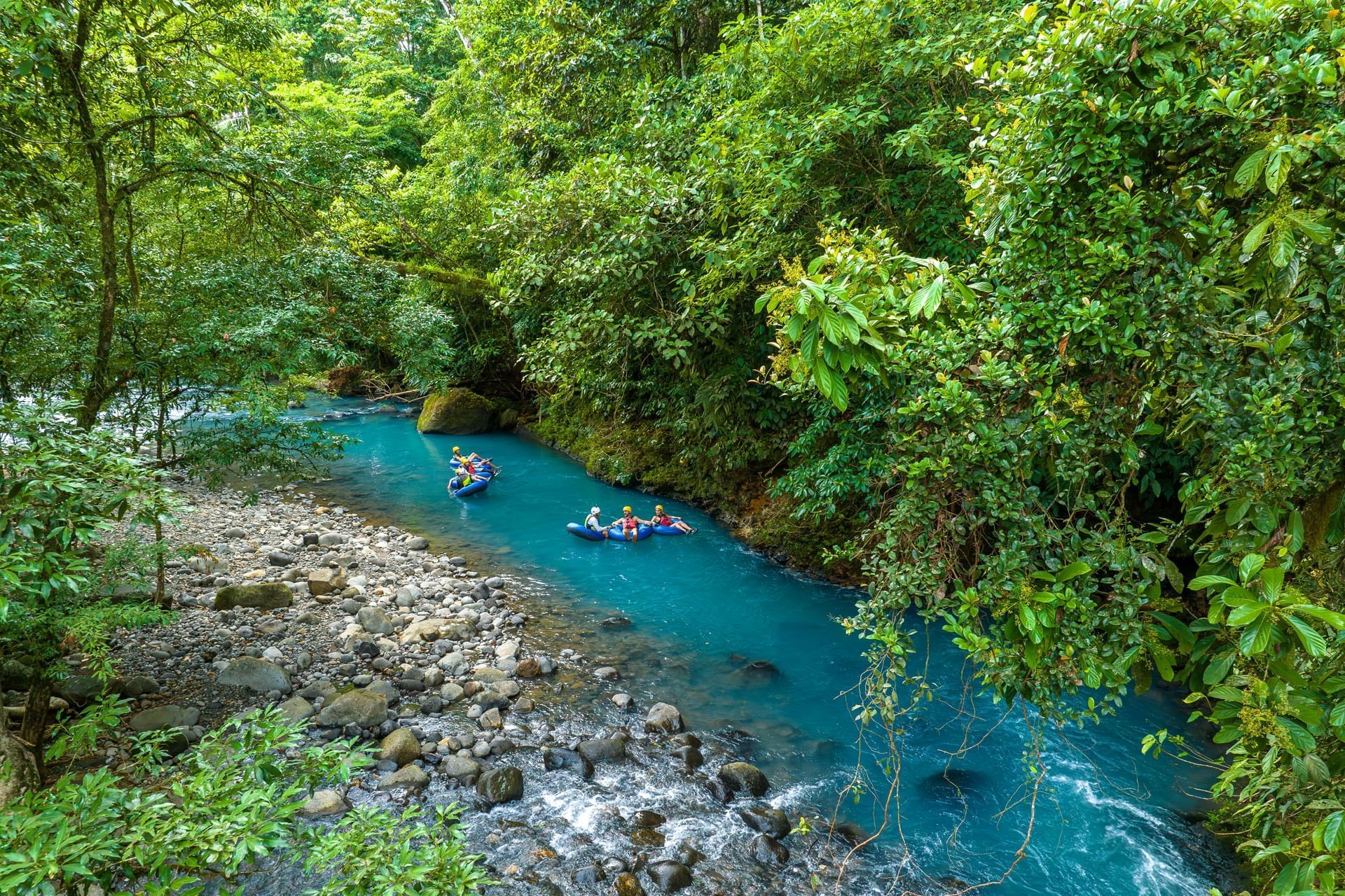
Can you swim in Río Celeste? Not inside Tenorio Volcano National…